Since the early 1990s, the concept of a split between East and West has prevailed in the political and public discourse of Ukraine. Ukraine’s public space was often presented as a battleground for two versions of the past linked to different identities: the Ukrainian nationalist versus the Soviet identity.

Sociological and political science studies focusing on Ukraine, including regionalism and differences in attitudes towards the past or identity in Ukraine, tend to group the largest Ukrainian administrative units (oblasts) into four or five macro-regions—East, West, South, Center, and Donbas.
Thus, oblasts, sometimes with a different historical background or social-demographic profile, are grouped together based on the arbitrary decisions of scholars limited by the constraints of sampling. Such an approach unavoidably levels differences among oblasts included in a single macro-region, heightens differences between macro-regions, and ignores the dynamic and complex character of individual oblasts. This macro-regional division scheme is still the technique most widely used by leading research companies and in scholarly publications on Ukraine. Such studies contribute to the formation of stereotypes of Ukrainian macro-regional divisions more than they help to reconsider Ukrainian regionalism.
Once created out of necessity as a research tool, macro-regions were then adopted by the media, which has contributed to the formation of a widespread belief that these regional differences are powerful predictors of political culture as well as people’s attitudes and practices in different parts of Ukraine. Political elites also have actively exploited myths about sharp regional divisions within the country, often turning them into a powerful tool for the political mobilization of their supporters. The political discourse has repeatedly stressed that Ukraine is divided along macro-regional lines (although the exact borders change over time) due to almost irreconcilable geopolitical orientations, language practices, economic values, etc. Such assertions are accompanied by numerous visual images and textual representations presented in social and mainstream media, artistic works, commercials, etc.
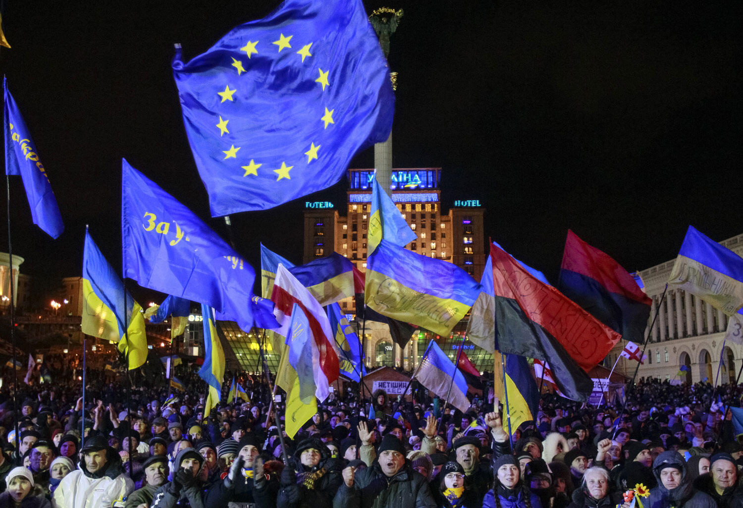
The symbolic opposition of the East and West in Ukraine’s public rhetoric and media reached its highest stage during the Orange Revolution and again during the Euromaidan. Despite this, the country has not split into East and West, but has effectively blocked foreign aggression.
When one analyzes the criteria used to define the interregional split in Ukraine, one is constantly confronted with arguments addressing its history and the way certain historical events and personalities are remembered by present-day Ukrainians. Differences in remembering and interpreting key historical events, together with language preferences, are often described as the primary factors dividing Ukrainian society.
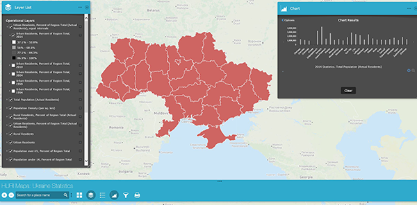
The History and Identity project as part of the MAPA program aims to contribute to a reconceptualization of regionalism in Ukraine. The project uses Geographic Information Systems (GIS) technology to map and analyze sociological data. Mapping data on the region (oblast) level avoids arbitrary scaling into predefined macro-regions, and allows researchers to explore and explain intraregional and cross-regional differences and similarities in the changing social and political context of 2013 and 2015 Ukraine. The “History and Identity” project contributes to the comparative cross-regional analysis of identities and historical memory in today’s Ukraine using the most recent sociological survey data.
Methodology
Studies that make use of representative samples of residents of Ukraine on a level of analysis other than the typical two to four macro-regions must involve a much larger number of respondents. The University of St. Gallen project “Region, Nation, and Beyond: An Interdisciplinary and Transcultural Reconsideration of Ukraine” aimed to overcome the stereotypical four-region method. Two surveys conducted in March 2013 (funded by the Swiss National Foundation) and March 2015 (funded by the Wolodymyr George Danyliw Foundation and the Swiss National Foundation) formed the basis for the spatial data analysis presented in the “History and Identity” project. Both surveys drew from a countrywide sample representative of Ukraine’s profile with respect to all administrative units, types of settlement (from villages to cities of over one million), gender, and age (respondents aged 18 and older). The number of respondents was large enough (N=6000, margin of error ≈ 2%) to allow us to draw maps with data representing each oblast separately and to avoid unnecessary macro-regional grouping.
The other data visualized in this project represent a survey conducted by the Razumkov Center in December 2015 titled “The Formation of the Common Identity of Ukrainian Citizens in New Circumstances: Peculiarities, Prospects and Challenges.” (The survey was funded by the Swedish International Development Cooperation Agency [SIDA], the Konrad Adenauer Foundation, and Social Transformation in Ukraine and Moldova [Matra]). It also had a large sample (N=10071, margin of error ≈ 1%) and was representative of Ukraine’s profile with respect to all administrative regions, settlement size, gender, and age (respondents aged 18 and older). Finally we used data for renamed toponyms and dismantled monuments released by the Ukrainian Institute of National Memory. Using the data from these surveys, we mapped the answers on 26 administrative regions where the interviews took place. For interviewers’ and interviewees’ safety, the 2015 surveys were not conducted in occupied Crimea or Donetsk and Luhansk oblasts, which were not under Ukrainian control.
Quantitative studies exploring historical identity and memory typically employ several different methodologies. The most widely used involves the research team creating a list of selected historical figures, events, or holidays, and measuring respondents’ attitude to them. Sometimes these questions are supplemented by additional opinion statements concerning certain historical events or celebrated holidays. This type of question was used in the surveys under consideration here.
Using this approach allows us to incorporate the variables produced by the data into a more sophisticated statistical model and into spatial data analysis. The disadvantage of such an approach is that researchers unavoidably are confronted with the inherent bias of a predefined list—scholars must decide arbitrarily which events and personalities are included and which are left out based on their own experience or theoretical background. The other problem is that the closed-answer measures give respondents the possibility to answer a question even if they know nothing about the subject on which they have been tested. This is a common occurrence, since respondents often do not want to reveal their lack of knowledge about a subject. One should also bear in mind that an analysis of answers to a closed list of questions about historical events, figures, or holidays gives us little understanding of the deeper meanings attributed to them or the practices of commemoration associated with them. Consequently, such survey questions should be interpreted more as a measure of the level of recognition of a holiday, figure, or event.
Our project is structured as a set of web maps presenting the regional (oblast level) division of respondents’ attitudes to the Euromaidan, the annexation of Crimea, and the Donbas conflict. Two map layers representing the annexed territory of Crimea and occupied territories of Donetsk and Luhansk regions can be enabled to exclude them from the map layers containing 2015 survey data as 2015 surveys were not conducted in those territories. To conduct geospatial analysis users can enable thematic (choropleth) map layers and then overlay them with chart map layers containing comparative data from the 2013 and 2015 surveys. The layers visualize respondents’ attitudes to monuments, holidays, historical figures, and events associated with the history of Ukrainian lands. These data sets also allow users to pose and seek answers to their own research questions using web map interactivity and built-in tools (widgets).
Each layer contains a pop-up window that displays attributes of a specific feature and a full survey question. For more information visit the user guide or consult the video tutorials.
This project is in copyright. If you reproduce any map, please refer to:
- Maps for March 2013, March 2015. Map Source: Harvard Ukrainian Research Institute. © 2017 The President and Fellows of Harvard College. Data Source: University of St. Gallen. Financial support: 2013 – the Swiss National Foundation, 2015 - the Wolodymyr George Danyliw Foundation and the Swiss National Foundation.
- Maps for December 2015. Map Source: Harvard Ukrainian Research Institute. © 2017 The President and Fellows of Harvard College. Data Source: Razumkov Center. Financial support: the Swedish International Development Cooperation Agency (SIDA), the Konrad Adenauer Foundation, and Social Transformation in Ukraine and Moldova (Matra).
- Maps based on the Ukrainian Institute of National Memory data. Map Source: Harvard Ukrainian Research Institute. © 2017 The President and Fellows of Harvard College. Data Source: Ukrainian Institute of National Memory.
Note: The hosting platform - ESRI's ArcGIS Online Web AppBuilder - automatically detects your web browser language preference and then presents the appropriate language. Although the application was built in English, a localized map viewer user interface will provide instructions and menu links in a localized language.
History and Identity Web Map
